
How to Get to McCarthy, Alaska: Driving the McCarthy Road
This article may contain affiliate links, meaning if you make a purchase, I may earn a small commission at no extra cost to you. As an Amazon Associate I earn from qualifying purchases. See my Disclosure Policy for more information.
Thinking about how to get to McCarthy, Alaska, but worried about the infamous McCarthy Road?
You’re not alone. Between stories of multiple flat tires, rental car restrictions, and remote stretches with no cell service, it’s easy to feel intimidated before you even leave Anchorage or Fairbanks!
I’ve driven this road more times than I can count and have seen it in both smooth conditions and very rough ones. McCarthy is my second home, and my family has been visiting our land and cabin here for nearly 20 years.
Here’s what most people don’t realize: getting to McCarthy isn’t difficult. It just takes time, preparation, and the right expectations.
In this complete guide, I’ll break down exactly how to get to McCarthy by car (including what you really need to know about the McCarthy Road), by small plane, or by shuttle. I’ll also cover rental car restrictions, seasonal road conditions, current hazards, and what to do before you leave town.
With the right preparation, the journey to McCarthy becomes part of the adventure, not something to fear.

If you are planning a trip to McCarthy, you may also find my other detailed guides helpful:
Where is McCarthy, Alaska?

McCarthy is a tiny, remote town located in the heart of Wrangell–St. Elias National Park in southcentral Alaska.
It’s a very special place in an incredibly cool location. I’ve been all over Alaska, and McCarthy is unique because it’s a real town connected to a National Park.
The town is at the end of the 60-mile McCarthy Road, which begins near Chitina and follows an old railroad corridor deep into the park.
McCarthy sits about 300 miles northeast of Anchorage and roughly 250 miles southeast of Fairbanks, but don’t let those numbers fool you!
The drive takes much longer than you’d expect because once you leave the main highways, you’re committed to a slow, remote gravel road with no services.
And that’s exactly why it feels so special when you arrive.
How to Get to McCarthy, Alaska

There are three main ways to get to McCarthy:
🚙 By driving the McCarthy Road (car, motorcycle, experienced RV drivers)
🛩 By small plane into the McCarthy airstrip
🚐 By shuttle van from Anchorage or Glenallen
Bikepacking to McCarthy from Chitina is also an option, though I don’t have personal experience with it.
Once you reach the bridge, it is a very short, easy bike ride into McCarthy. It’s one of the easiest and most practical ways to get around town.
My husband and I used to have bike trailers, and we always cycled into town during our stays, hauling all our gear (and kids) that way.
It’s a breeze to get around town on a bike, and the road up to Kennicott is also a great ride. Consider riding on the wagon road (located on the left of the road heading up to Kennicott) to avoid the dust on the road.
How Long It Really Takes to Drive to McCarthy
These estimates account for a realistic travel day, including fuel stops, road construction, and the inevitable scenic pull-offs.
My recommendation is to stay overnight somewhere along the way, such as in Copper Center, when traveling from Fairbanks or Anchorage. That way, you can arrive in McCarthy refreshed.
Anchorage to McCarthy: 314 mi (505 km), 8 hours
Fairbanks to McCarthy: 374 mi (602 km), 9 hours
Denali National Park to McCarthy: 359 mi (578 km), 9 hours (using Denali Hwy)
Valdez to McCarthy: 160 mi (257 km), 4.5 hours
Chitina to McCarthy: 60 mi (97 km), 2.5 hours
Car Rentals for Driving to McCarthy

It is very important to note that many car rental companies in Alaska have restrictions for traveling on dirt and gravel roads.
If you choose to ignore the restrictions of rental car companies, be aware that there are consequences. You will be fully responsible for any damage, and your insurance coverage can be voided for violating the rental agreement.
The following private car rental companies allow their vehicles on the McCarthy Road:
✔️ Midnight Sun Car Rental (Anchorage)
✔️ GoNorth (Anchorage and Fairbanks)
✔️ Alaska 4×4 Rentals (Anchorage, Prudhoe Bay, and Fairbanks)
✔️ Rent a Subaru (Anchorage)
✔️Alaska Adventure (Anchorage)
Alaska Adventure only allows travel on the McCarthy Road with prior authorization
🏍 You can also rent a motorcycle from Alaska Motorcycle Adventures. They allow rentals to drive to McCarthy and Kennicott but not beyond the Kennicott Visitor’s Center.
Anchorage to McCarthy
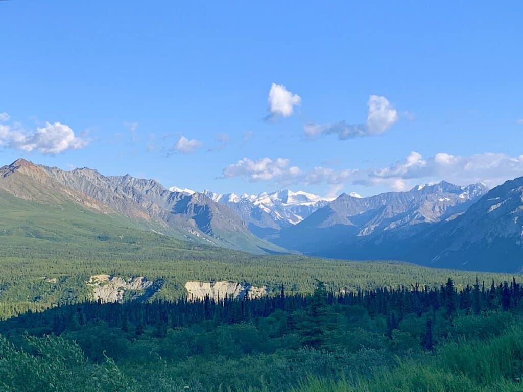
The driving distance from Anchorage to McCarthy is 307 miles and typically takes about 8 hours with stops for lunch and gas. From Anchorage, you’ll head north on the Glenn Highway, then continue through Glennallen toward Chitina.
The Glenn follows the Matanuska River through wide glacial valleys framed by steep mountains and seasonal waterfalls. It’s really beautiful!
The highway is paved and well-maintained, but summer construction zones are common delays and services can be far apart, so plan accordingly.
Use designated pull-offs, as traffic can move quickly on clear days.
The Matanuska Glacier turnout at Mile 99.3 holds about 6 cars and is worth stopping at despite its proximity to the official state recreation park entrance. This is the closest viewpoint available!
After about 3.5 hours of driving on the Glenn Highway, you will be at the intersection of the Tok Cut-Off and the Richardson Highway in Glenallen. This is the halfway point, time-wise, for the drive.
The Hub

Plan to fuel up at The Hub in Glennallen! Then you will take the Richardson Highway to the Edgerton Highway toward Chitina.
The Hub in Glenallen is at the intersection of the Glenn and Richardson Highways and is the last major gas station you can fill up your tank at before McCarthy.
The Hub is a great spot to pick up refreshments for the road and grab a quick meal! Spruce Burl Espresso and Tok Thai Food are two great tiny hut-style restaurants in the parking lot.
We have been stopping for a delicious Thai meal here for years. I enjoy the drunken noodles, curries, and larb. They also have a great Pad Thai. It’s cash only here, but there’s an ATM in the gas station.
Spruce Burl serves up delicious crepes, paninis, and burritos alongside a huge selection of hot, iced, and blended drinks. I usually grab an iced chai here or a matcha latte here! My son loves to get a milkshake.
A More Adventurous Route to McCarthy, Alaska, from Anchorage!
If you are up for making your travel to Anchorage something for the bucket list I recommend the following:
1️⃣ Drive from Anchorage to Whittier, Alaska, and stop at the Portage Glacier Lake viewing spot along the way, just before the Anton Anderson Memorial Tunnel.
2️⃣ Take the ferry from Whittier to Valdez, Alaska, and spend an extra day or two there as there are many things to do in Valdez!
3️⃣ Drive from Valdez to McCarthy via the Richardson Highway.
Fairbanks to McCarthy
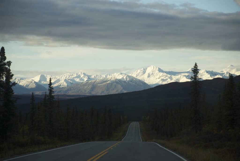
The driving distance from Fairbanks to McCarthy is 372 miles and usually takes about 9 hours with stops for lunch and gas.
The route takes travelers on the Richardson Highway and then onto the Edgerton Highway past Glenallen.
Notable landmarks you will drive through are the town of Delta Junction, the Alaska Range, Summit Lake, and Paxson Lake.
38 miles south of Delta Junction is a hidden gem. The Lodge at Black Rapids, built on the bluff overlooking the Black Rapids Glacier and Delta River, is open year-round and has a full-service restaurant serving three meals a day!
The Lodge at Black Rapids offers seemingly endless outdoor adventure opportunities, also year-round, ranging from ice cave exploration to fishing to their custom “chase the lights” tours to view the Northern lights.
Rainbow Ridge, 150 miles south of Fairbanks, is one of my favorite views early in the drive. You can pull off near mile 209 to try to spot some Dall sheep!
Delta Junction is the last full-service town before Glennallen. You will find all of the necessary services you need here, including restaurants.
Driving through the lakes area of Paxson, Alaska, has always been a favorite part of the drive for me. The weather here can be intense and there are no services.
Summit Lake is above the treeline, very exposed, and private cabins sit above the highway.

🏕 Paxson Lake Campground is at milepost 175 of the Richardson Hwy. The 50 campsites are first-come, first-served.
The chance of seeing wildlife, especially moose, is pretty good, as traffic is lighter along this stretch of the highway.
When you reach Glennallen, stop at The Hub to fill up your gas tank and grab a bite to eat! Take the Richardson Highway to the Edgerton Highway toward Chitina.
On the stretch between Glennallen and Chitina, there are more camping options as you get closer to McCarthy if you need a break.
Driving Through Chitina, Alaska


Before heading down the McCarthy Road, drive slowly through the small town of Chitina and take in the local scenery.
Chitina is about an hour and 15 minutes south of The Hub, in Glennallen.
Wrangell View Store is located in downtown Chitina overlooking Town Lake. They sell gas (typically more expensive than The Hub), along with ice, basic groceries, and fishing licenses. They do not carry diesel.
There are public bathrooms at the downtown Wayside located just before the start of the McCarthy Rd.
Need a place to stay in Chitina? The Hotel Chitina is located in downtown historic Chitina at Mile 33 of the Edgerton Highway. Email Susan Gilpatrick for room inquiries at: info@hotelchitina.com


There is also a fantastic little place called Grubsteak Grill at the wayside where you can stop for delicious homemade food such as fish tacos, reindeer dogs, biscuits and gravy, or special burgers.
We’ve enjoyed several quick, tasty meals here, and the owner is always friendly, which makes it even better! I lucked out and snagged a shrimp ceviche special on my last visit. They are open daily and until late in the evening too.
Other food options:
- Cast Iron Café: Across from the Wayside. All homemade options, including delicious wraps and pulled pork sandwiches.
- Uncle Tom’s Tavern: This is THE classic local bar in town, and they serve pizza. The decor includes stacked firewood, old license plates, and loads of memorabilia from years past.
- Koya’s Cup Espresso Hut (AK eXpeditions): Also at the Wayside. They serve coffee and other beverages as well as baked goods, oatmeal, and breakfast sandwiches.
⛺️ Looking for a place to camp?
There are several camping options near the start of the McCarthy Road, and camping in McCarthy is available at the end of the road near the Kennicott River!
Guide to Driving the McCarthy Road

The McCarthy Road is one of only two roads that enter Wrangell–St. Elias National Park. The other is the Nabesna Road on the north side of the park, which sees even less traffic.
The road follows the route of the Copper River Railroad line and winds through the Copper River Basin, homeland of the Ahtna People. Several National Park Service wayside stops along the drive share the history of the railroad and the region.
The McCarthy Road is not maintained to the same standard as Alaska’s main highways. Washouts, landslides, and rough conditions can occur.
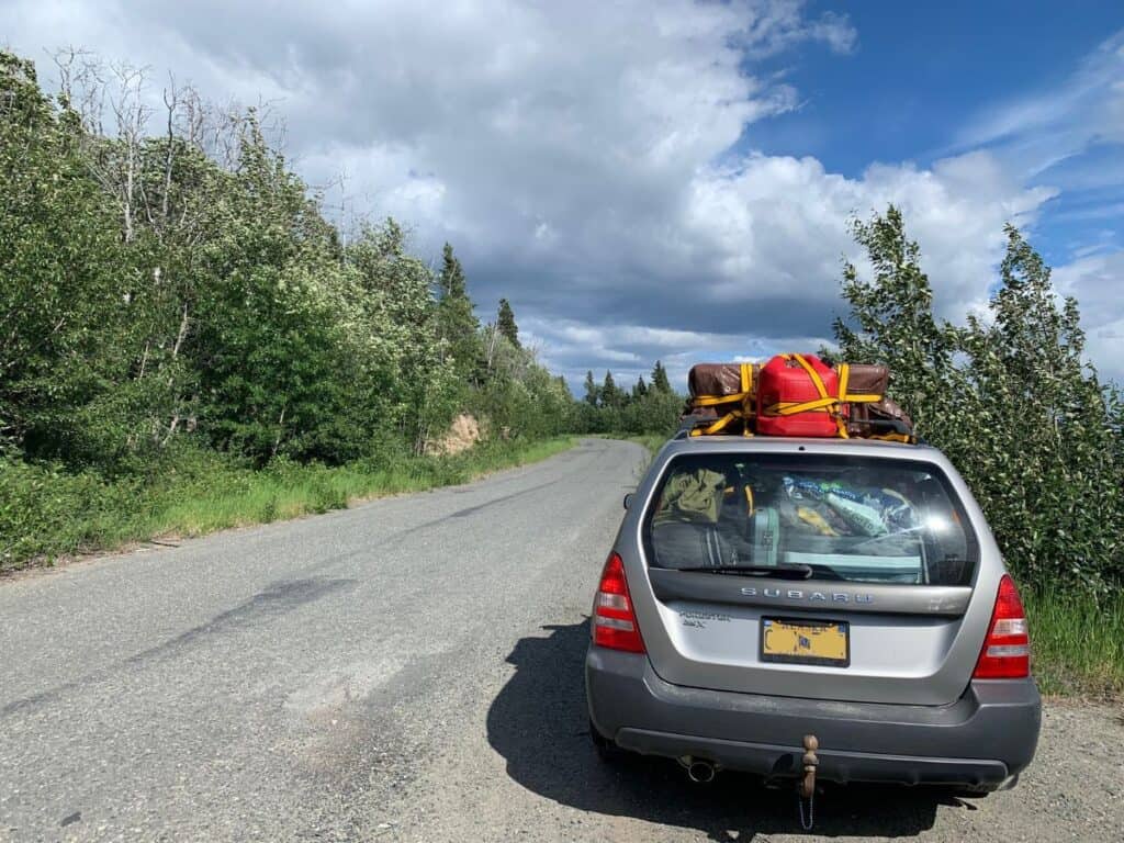
Driving the McCarthy Road is an incredible experience, but its remoteness requires preparation and patience. With realistic expectations and the right vehicle, it is a rewarding part of the journey into Wrangell–St. Elias.
📞 Call the DOT, Tazlina District, for current summer road conditions:
(907) 822-3222
Before You Drive the McCarthy Road
✔️ Have a vehicle in sound mechanical condition. 4WD is helpful but not required.
✔️ Carry a spare tire, jack, tire iron, and fix-a-flat. There is no roadside assistance on this road.
✔️ Cell service is extremely limited. Verizon and Copper Valley Telephone Cooperative are the only cell providers once you drive past Chitina.
✔️ Fill your gas tank in Glennallen before heading toward Chitina.
✔️ Be prepared to do things yourself. You should know how to change a tire confidently. Don’t expect services after Chitina!
✔️ Obey the 35 mph speed limit. The road is narrow, wildlife is common, it can be very dusty, and residents use it daily. Slow is safer.
✔️ Travel with water and snacks. If you experience delays or road trouble, they can make a long wait much easier.
Milepoints on The McCarthy Road

Mile 0
🚻 Begin your journey by stopping at the State Wayside, which marks the start of the McCarthy Road and has public-use toilets. Pass through the narrow rocks (called “the railway cut”), and you are on your way!
Mile 1
🛻 After taking in the immediate AMAZING views, you will drive across the first bridge where the Copper and Chitina Rivers meet.
This is a popular area where many Alaskans go dip netting for salmon.

The river’s edge is dotted with fishwheels, trucks, and campers. Keep an eye out for bald eagles here as well.
The shape of the rivers’ confluence changes yearly, and sadly, it isn’t uncommon to see locals’ campers or fish wheels partially swallowed up in the current.

Mile 1.5
🏕 Copper River Campground is an immediate turn to the right just past the bridge. This private campground has no nightly fee, there is no guarantee you will find an open campsite, and it is most popular with locals who fish in the area. RVs are allowed here.
⛺️ Mile 3
The Hilltop Campground on Ahtna land has spectacular views of the Copper and Chitina Rivers. Drive 0.2 miles to the top of the hill to camp. A land use permit is required to stay. RVs are allowed here.

Miles 10-12
🐟 There are three consecutive lakes with a pull-out for each. The first is Strelna Lake, the second is Silver Lake, and the third is Sculpin Lake.
All these lakes are stocked with rainbow trout by Alaska Fish and Game. A permit is needed to fish.

Mile 15.75
🏔 This National Preserve land marker is where you enter land managed by Wrangell-St. Elias National Park & Preserve.
Mile 17
🚻 Kuskulana Bridge Wayside: This turnout has bathrooms and trash receptacles. This one-lane bridge sits 238 feet above the Kuskulana River and is known as the “biggest thrill” on the road to McCarthy!

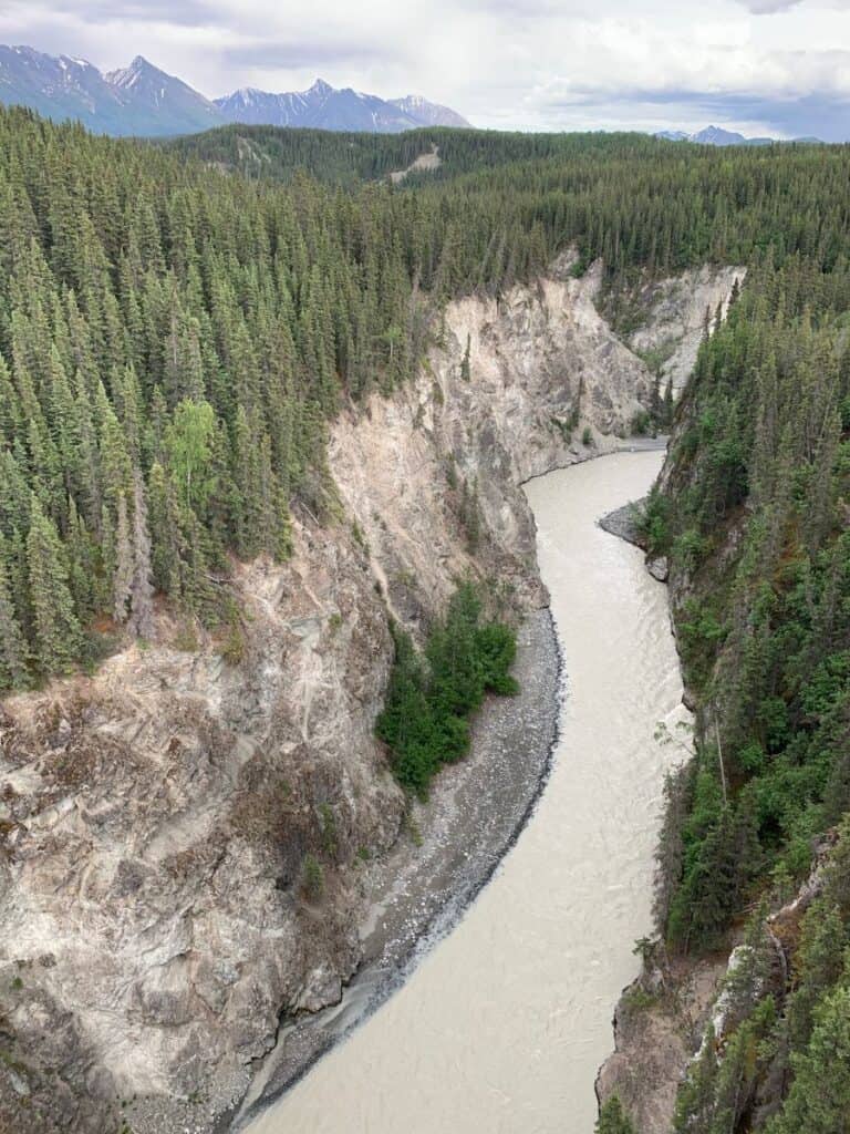

If you want an exciting view, park at the wayside and check it out! It is quite literally breathtaking and a tad scary for those impacted by heights.
The compact high-float road material ends, and the rougher gravel road starts after the Kuskulana bridge.

Miles 25-26.5
☕️ More beautiful views and another bridge at the Chokosna River are nearby a sometimes-open very local coffee stop: the Chokosna Trading Post.
There will be an open or closed sign indicating whether you should stop. The river here is a salmon spawning area as the waters are super clear and cold!
🏔 If you are lucky you can view Mount Blackburn from a distance here!


There are beautiful ponds and marshes in the vicinity and these are excellent wildlife viewing spots. Keep your eyes open for Trumpeter swans here!
Mile 29
🚻 Gilahina River and the Gilahina Trestle Wayside: this turnout has bathrooms and trash receptacles.
There is a short 1/2 mile hiking trail that departs from this rest area. It is not recommended to climb on the trestle.

Mile 34.5
🥾 This is where you can access the trailhead for the Crystalline Hills Trail. It is known as a great hike to spot some dall sheep on.
Look around on the hillside for white dots that look like snow spots, they may be sheep!
The moderately challenging 2.5-mile loop takes a couple of hours to hike and it is an excellent way to stretch your legs if you have been on a long drive if time allows.
🦟 PRO TIP: This trail can be extremely buggy in the summertime as it is a shaded area of forest. Bug spray is recommended to help ward off Alaskan mosquitoes!

Miles 40-45
🚧 One place (though not the only location) there is typically water running in the road is around mile 40. In the winter this turns into a glacier.
Due to changing road conditions and weather patterns this can and does happen at many other spots along the road.

However, despite potentially tricky conditions, you are continually rewarded by the views and an exciting road experience from this point onward.
It’s such a special road to have the opportunity to drive!

Here you are also entering privately-managed land and have exited the park preserve land. You will notice it becomes much more residential after the Lakina River Bridge.
There have been regular erosion problems and washouts of the long eastern approach to the Lakina Bridge.
Mile 45
📍 This is the Long Lake area! Salmon spawn in this lake having made their way up the rivers to this beautiful and fertile spot.
Most of the land surrounding the lake is Private Property. There is a private airstrip nearby as well.
From this point on the road narrows and please take caution to drive slower and be respectful of local families in the immediate area and the potential for kids playing nearby.

Mile 55
🚻 Wayside: this turnout has bathrooms and trash receptacles.
Mile 56
🛏 Here you will drive by the McCarthy Cabins, which are available to make a reservation at in advance.
Mile 57
🛏 Here you will pass the sign for Currant Ridge, beautiful private lodging available to reserve in advance.

Mile 60
🏁 You’ve made it to the end of the road and are about to start your next great adventure in McCarthy!
PARKING
Park at the footbridge at Base Camp Kennicott. Parking rates are per day (24 hours) or short-term (up to 4 hours).
✔️ Parking rates in the lot range from $10 per day, per vehicle. Or, folks can choose a short-term parking rate of $5 if staying for 4 hours or less.
Call for the latest rates: (907) 554-1062.

At the end of the road, you take the footbridge across the river to McCarthy, Alaska where shuttles are available every 30 minutes into town.
McCarthy is only ½ mile from this point. Walking is, of course, an option as well. Cycling into town from here is fun too if you’ve traveled with your bike!
It’s an easy, short ride. Further up the road is the historic Kennecott Mill, a National Historic Landmark.
Flying to McCarthy

If driving the McCarthy Road does not sound like the best option for you, there’s always the option of considering flights to McCarthy, Alaska.
It is also possible to fly into McCarthy airfield with your private plane.
Wrangell Mountain Air
The most affordable option is to fly from Chitina. Wrangell Mountain Air departs Chitina and McCarthy three times a day with one-way flights for $220.38, including tax. The round-trip cost is $440.75 per person.
For the time-pressed explorer, chartering a flight to McCarthy via Wrangell Mountain Air is an option and offers an exciting way to experience Alaska’s majestic scenery.
Charter flights range in price depending on departure location and can be chartered from many towns such as Fairbanks, Homer, and even Denali National Park.
Flying directly into McCarthy guarantees breathtaking views and quick access to your planned adventure.
Fly via Mail Plane or Air Taxi
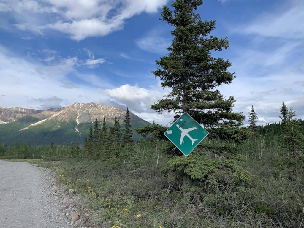
Connecting Alaska’s two iconic communities of Anchorage and McCarthy, Reeve Air Alaska (mail plane flights are Monday and Thursday) and Copper Valley Air work in partnership to offer convenient flights four days a week.
If you are hoping to explore the McCarthy-Kennicott region via these providers, Mondays, Wednesdays, Thursdays, or Saturdays are the days you can fly!
For more info and to make reservations contact:
Reeve Air Alaska: 907-646 0538
reservations@reevealaska.com
OR
Copper Valley Air: 907-822-4200
info@coppervalleyairservice
Riding a Shuttle Van to McCarthy

Several options are available for shuttle services to McCarthy. Whether you are starting in Anchorage or traveling by bus from Fairbanks to Glenallen, simply make your reservations ahead of time and enjoy the scenery.
Bus
Buses go to Glenallen only. Once in Glenallen, shuttles run from here to McCarthy daily via Kennicott Shuttle. The shuttle trip takes 4 hours including stops.
From Anchorage to Glenallen: Take the bus via Interior Alaska Busline on a Monday, Wednesday, or Friday, year-round. Call: 1-800-770-6652
Overflow Transit
If you are traveling from Anchorage to McCarthy you can take a shuttle service in a Ford Transit van via Overflow Transit. Their service runs twice a week, in each direction, from May through September.
✔️ The cost for this service is $225/per person, one way and it is 9 hours including stops.
Kennicott Shuttle
In the summer months, Kennicott Shuttle offers daily van service from Glennallen to McCarthy for backpackers and scheduled shuttle services between Anchorage and McCarthy.
✔️ Call for current rates: 907-822-5292, or email: kennicottshuttle@gmail.com
Coppertown Shuttle
The Coppertown Shuttle leaves Anchorage every Friday by 9am to arrive in McCarthy by 6pm. Every Sunday the shuttle leaves McCarthy by 9am and arrives in Anchorage by 6pm.
Shuttle service begins in late May and continues through Labor Day.
The shuttle stops (as requested) in Palmer at Fred Myers, Glennallen at The Hub, Kenny Lake at the Mercantile, and Chitina Airstrip.
✔️ Call for current rates, which are about $200 each way: 907-554-4402
Combo Option
Get the best of both worlds on your journey to Wrangell-St. Elias National Park – COMBINE a road trip with an aerial excursion!
Take in spectacular views from above and below, starting off by van from the Chitina airport with Kennicott Shuttle then flying back to Chitina courtesy of Wrangell Mountain Air.
✔️ The shuttle drive to McCarthy from Chitina takes about 2.5 hours.
💡 FAQS: How to Get to McCarthy, Alaska

It can be a lot to take in all of the considerations involved when trying to get to the historic town of McCarthy, Alaska. Here are some answers to some commonly asked questions!
Can you drive to McCarthy, Alaska?
Yes, if you have either your own car or a rental car approved for travel on McCarthy Road you can absolutely drive to McCarthy! Important considerations for driving include seasonal challenges and weather. Never drive the road without a spare tire or two. Roadblocks due to mudslides can occur so stay informed on current conditions.
Shoulder season or winter conditions can include ice and glaciers across the road, slush, or ice topped with water. The winter hazards can land you in a ditch pretty easily.
It is recommended that only experienced RVers drive on the McCarthy Road. Campsites for RVs are available at the start of the road nearest to Chitina and at the end of the road near McCarthy.
Is the road to McCarthy open?
The McCarthy Road is typically open year-round but it is definitely not maintained 100% of the time due to its remote location, challenging conditions, and state resources. It is best to travel the road in the summer months. After September the road can be closed periodically for mudslides and chaining up can be necessary at times in the winter.
How long is the drive on the McCarthy Road?
The road to McCarthy is 60 miles. The amount of time it takes to drive the road varies. Plan on the drive taking an average of 2 hours each way. In challenging conditions with mudslides and water damage, it can take 3-4 hours each way. The road can be closed in the winter months due to conditions.
Is the road to McCarthy Alaska paved?
No, the road to McCarthy Alaska is not paved. The section from Mile 3 to Mile 17 is the closest thing to paving in the road’s history. But, the “high float” material found on that section isn’t pavement – it’s crushed rock over emulsion oil, similar to chip seal. The rest of the road is gravel.
Do rental agencies let you drive on McCarthy Road?
No, most car rental agencies will not let you drive on the McCarthy Road. This 60-mile gravel road is considered too remote and treacherous for most car rental companies to insure, making it off-limits for their customers. There can be hazards on the road such as mudslides, giant potholes, and railroad spikes, just to name a few.
How much does it cost to fly to McCarthy Alaska?
The cost to fly into McCarthy Alaska depends on where you are coming from and what route you take. The most affordable option is to fly from Chitina. Wrangell Mountain Air departs Chitina and McCarthy three times a day with one-way flights for $220.38, including tax. The round-trip cost is $440.75 per person.
Final Thoughts on How to Get to McCarthy Alaska

If you’re looking for a memorable and adventurous journey, there’s no doubt that heading to this unique remote area smack dab in the middle of Wrangell St Elias National Park is for you.
Get ready to enjoy some of the most spectacular scenery!
Now that you know exactly how to get to McCarthy, the next step is deciding where to stay and how to plan your time.
Start with my complete guide to the best things to do in McCarthy so you can map out your days before you even arrive.

Thank you very much for this interesting and informative write up. My daughter & husband are driving this in a camper van and I was curious.
You’re so welcome! I am glad you found it helpful 🙂 They are going to have such an amazing time driving Alaska in a camper van!
Hi Heather, I was looking for news on the 7.0 earthquake today, and found your posts. I remember well the trip from Anchorage to McCarthy in 1994 with the Kennecott Kids and your pictures and descriptions are a wonderful reminder. I was the only person ever born in McCarthy, since there was no hospital there in 1934 when the mine’s hospital was temporarily shut down for some reason. My birth home was the house that later became a Pizza Parlor in the 90,s. It may still be there. Me and my sister Jeanne may be the only surviving members of the “Kids” at 91 and 95 years old but have our memories of the most beautiful place on earth from that trip. You’re so lucky to be able to enjoy it now.
Thank you so much for taking the time to write this. I’m truly honored you found your way here and shared these memories. McCarthy has a way of staying with people, and hearing from someone who was actually born there, especially during that era, feels incredibly meaningful.
I love that my photos brought some of your memories back. Knowing your birth home later became the pizza parlor in the 90s makes me smile. It is no longer there though!
I’m so glad you and your sister Jeanne carry those memories with you. McCarthy continues to be a very special place for our family (we feel so lucky), and hearing from someone who experienced it so early in its history reminds me just how deep its roots go. Thank you again for sharing this with me.
Also, I hear there is a photo of you as an infant in the museum so I will check it out when I visit McCarthy this summer!
This is a dream of mine. I live in the southeast US and would love to go there. It seems to be exciting but I am a little nervous
Hi Carl! McCarthy is a special place and worth dreaming about! Let me know how I can help you plan a visit. Happy to advise in any way. 🙂
My husband and I are starting to plan a 3 month trip from Missouri to Alaska July of 2027, We will be pulling a 5th wheel trailer with our Chevy Silverado 2500 diesel. We’d like to experience all the Alaskan NPs. Found your information about McCarthy and feel like this would be perfect. We’d want to leave the 5th wheel and only drive the truck and maybe bring camping gear or maybe stay a night there. Where would you suggest we leave our 5th wheel (RV park that holds a 28′ one). Should we plan on hauling extra diesel fuel along with your other suggestions? We would have bikes with us. We are just getting started so any suggestions appreciated for the other parks in AK. Currently working a seaplane to Kanai Peninsula to the viewing platforms. Any company we should avoid using? Oh, we are 70 years young but travel savvy and hikers.
What an amazing trip you’re planning! For McCarthy, I’d leave the fifth wheel in the Chitina area and drive the truck down the McCarthy Road. Wrangell View RV Park would be a good place to contact regarding your 28-foot trailer.
I would fill up with diesel in Chitina, but your truck should have plenty of range for the roughly 120-mile round trip. You’ll have to do the math for your diesel usage for the rest of the drive! We always carry extra fuel just in case.
Your bikes would be useful once you cross the footbridge, especially for getting between McCarthy and Kennecott. I’d plan on staying at least one night, and ideally two, so you have time for Kennecott and the Root Glacier area.
For the bear-viewing platforms, I believe you’re looking at Brooks Camp in Katmai. Some flights leave from Homer, but be sure the company is actually taking you to Brooks Camp, since other tours visit different bear-viewing areas. I don’t have a specific company I’d warn you against.
Visiting all eight Alaska national parks will take some careful planning since several require bush flights, boats, or both, but three months gives you a wonderful amount of time!